7 February، 2021
An E-Training course on QGIS in Dams and Water Resources Engineering

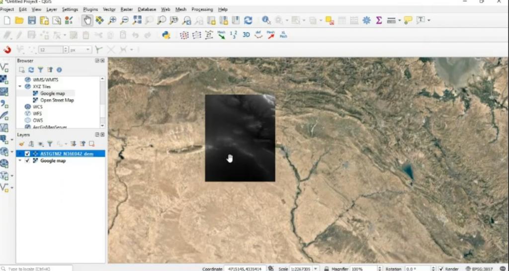
Department of Dams and Water Resources Engineering at College of Engineering held an electronic training course on “Gradient contour mapping of irregular shapes using QGIS 3.8 software” presented by Dr. Nashwan Kamalaldeen Mohammed and Dr. Talal Ahmed Bashir for three days, (54) researchers and postgraduate students participated in it.The course included an introduction to the program and its attachments, in addition to the use and application of instructions for converting laboratory or field data from (Excel) to contour maps, and the mechanism for inserting contour maps on aerial maps.